Surya S. Durbha, Ph.D.
Ph.D. – Computer Engineering
Mississippi State University (MSU), USA
Professor
Centre of Studies in Resources Engineering (CSRE),
Indian Institute of Technology Bombay
Powai, Mumbai – 400 076, India
Office Phone: (022) 2576-7679
E-mail : sdurbha[at]iitb[dot]ac[dot]in
Key Research Interests
Geospatial Standards and Semantics, Knowledge-based Systems, Image Information Mining, Internet of Things, Cloud Computing-based Geo-Computations, Interoperability, Sensor Webs, Critical Infrastructure Protection, Remote sensing, Bio-Physical Variables Retrieval from Remote Sensing Data
Teaching
- GNR 629: Advances in Geospatial Standards, Interoperability and Knowledge Discovery
- GNR 636: Remote Sensing of Vegetation
- GNR 402: Introduction to Geographic Information Systems
Professional Experience
-
- Professor (December 2018 – Present)
Centre of Studies in Resources Engineering, Indian Institute of Technology Bombay
- Professor (December 2018 – Present)
- Associate Professor (2014 – November 2018)
Centre of Studies in Resources Engineering, Indian Institute of Technology Bombay - Assistant Professor (2011 – 2014)
Centre of Studies in Resources Engineering, Indian Institute of Technology Bombay
- Assistant Research Professor (Jul 2009 – March 2011)
Center for Advanced Vehicular Systems (CAVS) Mississippi State University - Adjunct Assistant Research Professor (2007 – 2011)
Department of Electrical and Computer Eng. Mississippi State University - Assistant Research Professor (Dec 2006 – June 2009)
Geosystems Research Institute (GRI), Mississippi State University - Scientist (SD), (1998-2001)
Photogrammetry and Remote Sensing Division, Indian Institute of Remote Sensing (IIRS)
Department of Space, Govt. of India - Product Executive (1997 – 1998)
Rolta India Ltd.
Awards & Honors
- Professor S.P. Sukhatme Excellence in Teaching Award, Excellence in Teaching – 2022
- NVIDIA Innovation award, NVIDIA, 2016
- Excellence in Teaching award, IIT Bombay, 2016
- State Pride Faculty Award (2010), Mississippi State University
- Outstanding Research Award (HM) (2008), GRI, Mississippi State University.
- Best paper, International conference on Geoinformatics and natural resource assessment, monitoring and management. 9-11, March-1999, India.
Synergistic Activities – Professional
- Disclosure filed at NASA eNTRe system on a new technology Report (NF1679) by MSU
office of technology and commercialization: Report title: Semantics-Enabled Knowledge Retrieval from Earth Observation Data Archives - Patent: Sawant S.A., Durbha S.S., J. Adinarayana. SenseTube: Interoperable Wireless Sensing System for Precision Agriculture, Patent File Number: 2236/MUM/2015. (Status: Published)
-
- Co-instructor for a full day Tutorial on “Advanced Classification Techniques for remote
sensing “at International Geoscience and Remote Sensing Symposium (IGARSS 2009, 2010, 2012). - Program Committee Member
- Pattern Recognition in Remote Sensing (2012, 2014, 2016)
- Big Spatial, 2015
- PetascaleData Analytics: Challenges, and Opportunities (PDAC-12)
- ICVGIP12
- Spatial and Spatio-temporal data mining (SSTDM 08, 09, 10,11,12)
- Theme Coordinator/Session Organizer
- IGARSS (2009, 2014, 2015, 2016, 2017, 2018)
- Semantic Scientific Knowledge Integration (SSKI) Symposium, Stanford
- Invited Session Co-Chair
- IGARSS 2009, 2010, 2011
(Data Mining and Machine Learning for Remote Sensing)
- IGARSS 2009, 2010, 2011
- Co-instructor for a full day Tutorial on “Advanced Classification Techniques for remote
-
- Technical Planning Committee Member
- IEEE Geoscience and Remote Sensing Symposium (IGARSS 2010).
- Technical Planning Committee Member
-
- Session Co-Chair
-
- GIS Techniques and Standards (oral), Geographic Information Science: Techniques (oral)
- GIS Techniques and Standards I (poster), GIS Techniques and Standards II (poster)
-
- Session Co-Chair
-
- Technical Planning Committee Member, IEEE Geoscience and Remote Sensing Symposium (IGARSS 09).
-
- Member: Bagley Research Advisory Committee (2007)
- Co-Chair: IEEE Geoscience and Remote Sensing Symposium 08 (Geographic Information Science Applications Session, Data Mining Tools and applications Session, Geographic Information Science tools Session)
- Manuscript Reviewer
- Journals
- Computers and Geosciences Journal
- IEEE Geoscience and Remote Sensing
- IEEE Geoscience and Remote Sensing Letters
- IEEE Journal of Selected Topics in Applied Earth Observations and Remote Sensing
- Geoinformatica
- International Journal of Image and Data Fusion
- Earth Science Informatics (Springer)
- Optical Engineering
- Journal of Geomatics
- Computers and Electronics in Agriculture.
- Conferences
- IGARSS (2008-2020)
- SSTDM (2008-2017)
- IAPR Workshop on Pattern Recognition in Remote Sensing
- PRRS-2012,2014, 2016,2017
- SSTDM-2015, 2016,2017
- Big spatial 2015,16,17
- ICSD-2015
- Petascale Data Analytics: Challenges and Opportunities (PDAC-12)
- SSKI 2008
- Journals
Thesis Advisor and Postgraduate Scholar Sponsors
(5 Ph.D., 24 M.Tech.)
- 2017 – current Supervisor for 4 PhD students, Co-supervisor to 4 PhD students, CSRE, IIT Bombay
- 2011-2017 Supervisor to 12 M.Tech and Co-supervisor to 4 M.Tech Students
- 2008-2010 Co-Major Professor for 6 students (MSU, USA)
- 2008-2010 Ph.D. Graduate committee member for 4 students (MSU, USA)
- 2007- 2010 PhD. Co-Major Professor and dissertation Supervisor for 1 student (MSU, USA)
Peer-Reviewed Journals
2023
- Rajat C. Shinde, Surya S. Durbha; Deep Convolutional Compressed Sensing-Based Adaptive 3D Reconstruction of Sparse LiDAR Data: A Case Study for Forests. Remote. Sens. 15(5): 1394 (2023)
- Rajat C. Shinde, Surya S. Durbha; Adaptive LiDAR Reconstruction by Convolutional Compressive Sensing Network and Multivariate Empirical Mode Decomposition. Signal Process. 213: 109194 (2023)
2021
- Rajat C. Shinde, Surya S. Durbha, Abhishek V. Potnis
LidarCSNet: A Deep Convolutional Compressive Sensing Reconstruction Framework for 3D Airborne Lidar Point Cloud. ISPRS Journal of Photogrammetry and Remote Sensing 180 (2021) 313-334, https://doi.org/10.1016/j.isprsjprs.2021.08.019. - Soumyashree Kar, Vikram Kumar Purbey, Saurabh Suradhaniwar, Lijalem Balcha Korbu, Jana Kholová, Surya S. Durbha, J. Adinarayana, Vincent Vadez, An ensemble machine learning approach for determination of the optimum sampling time for evapotranspiration assessment from high-throughput phenotyping data, Computers and Electronics in Agriculture, Volume 182, 2021, 105992, ISSN 0168-1699, https://doi.org/10.1016/j.compag.2021.105992.
- A. V. Potnis, S. S. Durbha and R. C. Shinde, “Semantics-Driven Remote Sensing Scene Understanding Framework for Grounded Spatio-Contextual Scene Descriptions”, ISPRS Int. J. Geo-Inf. 2021, 10, 32. https://doi.org/10.3390/ijgi10010032
2020
- Soumyashree Kar, Vincent Garin, Jana Kholová, Vincent Vadez, Surya S. Durbha, Ryokei Tanaka, Hiroyoshi Iwata, Milan O. Urban and J. Adinarayana
SpaTemHTP: A Data Analysis Pipeline for Efficient Processing and Utilization of Temporal High-Throughput Phenotyping Data. Frontiers in Plant Science, 2020. https://doi.org/10.3389/fpls.2020.552509. - Nivedita Nukavarapu and Surya Durbha
Interdependent Healthcare Critical Infrastructure Analysis in a Spatiotemporal Environment: A Case Study. ISPRS International Journal of Geo-Information, 9(6) pp.387, 2020.
2018
- Ujwala Bharambe, Surya S. Durbha (2018), Adaptive Pareto-based approach for geo-ontology matching, Computers and Geosciences 119 (2018) 92–108
- M. R. Badnakhe, S. S. Durbha, A. Jagarlapudi, R. M. Gade. (2018). Evaluation of Citrus Gummosis disease dynamics and predictions with weather and inversion based leaf optical model. Computers and Electronics in Agriculture, Volume 155, 2018, Pages 130-141, ISSN 0168-1699, Elsevier
2017
- U. Bhangale., S. S. Durbha, R. L. King., N. H Younan., & R. Vatsavai. (2017) . High performance GPU computing based approaches for oil spill detection from multi-temporal remote sensing data. Remote Sensing of Environment, Elsevier.
- S. Sawant, S. S. Durbha, A. Jagarlapudi,(2017), Interoperable agro-meteorological observation and analysis platform for precision agriculture: A case study in citrus crop water requirement estimation, “Computers and Electronics in Agriculture”, Volume 138, Pages 175-187, 2017 (Elsevier)
2016
- K. R. Kurte, S. S. Durbha, R. L. King., N. H Younan., & R. Vatsavai. (2016). Semantics-Enabled Framework for Spatial Image Information Mining of Linked Earth Observation Data. IEEE Journal of Selected Topics in Applied Earth Observations and Remote Sensing, 10(1), 29-44.)
2012
- S. S. Durbha, R. L. King, A. Prakash, & N. H. Younan, (Aug 2012). Transfer Learning for Image Information Mining Applications. International Journal of Image and Data Fusion Taylor & Francis, 10, 17. DOI: 10.1080/19479832.2012.698658.
- Gokaraju, B., Durbha, S. S., King, R. L., & Younan, N. H. (2012). Ensemble methodology using multistage learning for improved detection of harmful algal blooms. IEEE Geoscience and Remote Sensing Letters, 9(5), 827-831.
2011
- Gokaraju, B., Durbha, S. S., King, R., & Younan, N. H. (Sep 2011). A Machine Learning Based Spatio-Temporal Data Mining Approach for Detection of Harmful Algal Blooms in the Gulf of Mexico. IEEE Journal of Selected Topics in Applied Earth Observations and Remote Sensing IEEE, 4(3), 710-720. [Document Site]
- Han, F. X., King, R., Lindner, J., Yu, T.Y., Durbha, S. S., Younan, N. H., Su, Y., Luthe, J. C., & Plodinec, J.M. (Jan 2011). Nutrient Fertilizer Requirements for Sustainable Biomass Supply to Meet U.S. Bioenergy Goal. Biomass and Bioenergy Elsevier, 35, 253-262.
2010
- Durbha, S. S. King, R. L. Amanchi, S. K. Bheemireddy, S. Younan, N. H (2010). Standards Based Middleware and Tools for the Coastal Sensor Web Applications, IEEE Journal of Selected Topics in Applied Earth Observations and Remote Sensing, 3(4), 451-466.
- Durbha, S. S., King, R. L., and Younan, N. H. (Jan 2010). Wrapper-Based Feature Subset Selection for Rapid Image Information Mining, Geosciences and Remote Sensing Letters IEEE, 7(1), 43 – 47.
- Shah, V. P., Younan, N., Durbha, S.S., & King, R.L (Jan 2010), Feature Identification via a Combined ICA–Wavelet Method for Image Information Mining, Geosciences and Remote Sensing Letters IEEE, 7(1), 18 – 22
2009
- Durbha, S.S., King, R.L., Shah, V. P., and, Younan, N. H. (Apr 2009). A Framework for Semantic Reconciliation of Disparate Earth Observation Thematic Data, Computers and Geosciences.
2008
- Durbha, S.S., King, R., & Younan, N. (Sep 2008). An Information Semantics Approach for Knowledge Management and Interoperability for the Global Earth Observation System of Systems. IEEE Systems Journal, IEEE, 2(3), 358-365.
2007
- Durbha, S.S., King, R., & Younan, N. (Mar 2007). Support Vector Machines Regression for Retrieval of Leaf Area Index from Multiangle Imaging Spectroradiometer. Remote Sensing of Environment, 107(1), 348-361. (44 citations: http://scholar.google.co.in/scholar cites=3451314226395431824&as_sdt=2005&sciodt=0,5&hl=en)
- Shah, V. P., Younan, N., Durbha, S.S., & King, R. L (2007). A Systematic Approach to Wavelet Decomposition Level Selection for Image Information Mining from Geospatial Data Archives. IEEE Transactions on Geoscience and Remote Sending, 45(4), 875-878.9
2005
- Durbha, S. S., and King, R. L. (Nov 2005). Semantics-enabled framework for knowledge discovery from earth observation data archives, IEEE Transactions on Geosciences and Remote Sensing, Vol.43, NO.11.
2001
- Durbha, S. S., and Roy, P. S. (2001), Remote Sensing in Strategic Applications, Defence Science Journal, Defence Research & Development Organization (DRDO), Ministry of Defence, Government of India.
1998
- Aparna, N., Kant, Y., Durbha, S. S., and Badrinath, K.V.S. (1998). Atmospheric Correction Algorithm for IRS-1C data, Journal of Indian Geophysical Union, vol-2, No.1, pp35-40.
- Prasad, K. V., Kant, Y., Durbha, S. S., and Badrinath, K.V.S (1998), Studies on Bio-diversity using Semivariogram approach from IRS-1C data, Journal of Indian Society of Remote Sensing, vol.26, no.3.
Peer-Reviewed Conference Papers
- Pratyush V. Talreja, Surya S. Durbha, Rajat C. Shinde, Shreelakshmi C. R; Unsupervised Domain Adaptation Using Generative Adversarial Network for Extreme Events Monitoring. IGARSS 2023: 1672-1675
- Keshav Agrawal, Surya S. Durbha, Pratyush V. Talreja, Nivedita Nukavarapu; Deep Reinforcement Learning Driven Critical Infrastructure Protection During Extreme Events. IGARSS 2023: 2540-2543
- Archana G. Pai, Krishna Mohan Buddhiraju, Surya S. Durbha; Texture Based LULC Classification of Images Using QSVM. IGARSS 2023: 4423-4426
- Shreelakshmi C. R, Surya S. Durbha, Rajat C. Shinde, Pratyush V. Talreja, Gaganpreet Singh; Unsupervised Stream Learning for 3D Lidar Point Clouds. IGARSS 2023: 4451-4454
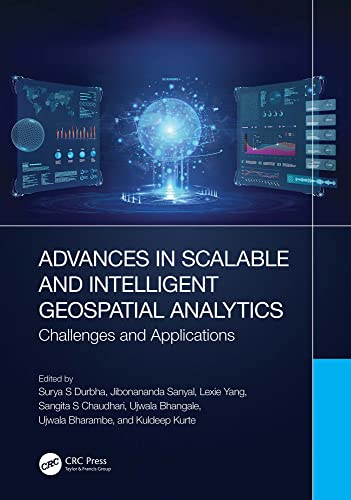
- Surya S Durbha, Jibonananda Sanyal, Lexie Yang, Sangita S Chaudhari, Ujwala Bhangale, Ujwala Bharambe, Kuldeep Kurte (Eds) ( 2023), Advances in Scalable and Intelligent Geospatial Analytics Challenges and Applications, pp 421, https://doi.org/10.1201/
9781003270928 - RC Shinde, SS Durbha, AV Potnis, P Talreja, G Singh
Towards Enabling Deep Learning-Based Question-Answering for 3D Lidar Point Clouds, IEEE International Geoscience and Remote Sensing Symposium (IGARSS 2021) - G Srikanth, N Nukavarapu, S Durbha
Deep Reinforcement Learning Interdependent Healthcare Critical Infrastructure Simulation model for Dynamically Varying COVID-19 scenario-A case study of a Metro City, IEEE International Geoscience and Remote Sensing Symposium (IGARSS 2021) - P Talreja, SS Durbha, RC Shinde, AV Potnis
Real-Time Embedded HPC Based Earthquake Damage Mapping Using 3D LiDAR Point Clouds, IEEE International Geoscience and Remote Sensing Symposium (IGARSS 2021) - AV Potnis, SS Durbha, RC Shinde, PV Talreja
Towards Visual Exploration Of Semantically Enriched Remote Sensing Scene Knowledge Graphs (RSS-KGs), IEEE International Geoscience and Remote Sensing Symposium (IGARSS 2021) - Parashuram Shourya Rajulapati, Nivedita Nukavarapu, Surya Durbha
Deep Learning-based Critical Infrastructure Simulation Model for Disaster Monitoring, IEEE International Conference on Data Mining Workshops (ICDMW 2020)
- Utkarsh Kulshrestha, Surya Durbha
Edge Analytics and Complex Event Processing for Real Time Air Pollution Monitoring and Control, IEEE International Geoscience and Remote Sensing Symposium (IGARSS 2020) - Parashuram Shourya Rajulapati, Nivedita Nukavarapu, Surya Durbha
Multi-Agent Deep Reinforcement Learning based Interdependent Critical Infrastructure Simulation Model for Situational Awareness during a Flood Event, IEEE International Geoscience and Remote Sensing Symposium (IGARSS 2020) - Rajat C Shinde, Abhishek V Potnis, Surya S Durbha
Online Point Cloud Super Resolution using Dictionary Learning for 3D Urban Perception, IEEE International Geoscience and Remote Sensing Symposium (IGARSS 2020) - Abhishek V Potnis, Rajat C Shinde, Surya S Durbha
Towards Natural Language Question Answering Over Earth Observation Linked Data Using Attention-Based Neural Machine Translation, IEEE International Geoscience and Remote Sensing Symposium (IGARSS 2020) - Nivedita Nukavarapu and Surya Durbha, Healthcare Critical Infrastructure Stochastic Interdependencies Simulation Model For Smart Cities: Flood Disaster Scenario. ISPRS Ann. Photogramm. Remote Sens. Spatial Inf. Sci., V-4-2020, 123–129, 2020.
- K. Kurte, A. Potnis, S. Durbha, Semantics-enabled Spatio-Temporal Modeling of Earth Observation Data: An application to Flood Monitoring. ACM SIGSPATIAL International Workshop on Advances in Resilient and Intelligent Cities (ARIC 2019)
- A. Potnis, R. Shinde, S. Durbha, K. Kurte, Multi-Class Segmentation of Urban Floods from Multispectral Imagery using Deep Learning, IEEE International Geoscience and Remote Sensing Symposium (IGARSS 2019), Japan
- K. Kurte, A. Potnis, S. Durbha, R. Shinde, A Semantic Framework for Spatial Query Reformulation for Disaster Monitoring Applications, IEEE International Geoscience and Remote Sensing Symposium (IGARSS 2019), Japan
- R. Shinde, A. Potnis, S. Durbha, P. Andugula, Compressive Sensing based Reconstruction and Classification of VHR Disaster Satellite Imagery Using Deep Learning. IEEE International Geoscience and Remote Sensing Symposium (IGARSS 2019), Japan
- U. Bhangale, S. Durbha, A. Potnis, R. Shinde, Rapid Earthquake Damage Detection using Deep Learning from VHR Remote Sensing Images, IEEE International Geoscience and Remote Sensing Symposium (IGARSS 2019), Japan
- Abhishek Potnis, Surya Durbha, Kuldeep Kurte, A Geospatial Ontological Model for Remote Sensing Scene Semantic Knowledge Mining for the Flood Disaster, IEEE International Geoscience and Remote Sensing Symposium (IGARSS 2018), Spain
- Pratyush Talreja, Surya Durbha, Abhishek Potnis, On-Board Biophysical Parameters Estimation using High Performance Computing, IEEE International Geoscience and Remote Sensing Symposium (IGARSS 2018), Spain
- KR Kurte, SS Durbha, RL King, NH Younan, R Vatsavai, Semantics-enabled framework for spatial image information mining of linked earth observation data, IEEE Journal of Selected Topics in Applied Earth Observations and Remote Sensing
- Durbha Surya, Kuldeep Kurte, Ujwala Bhangale, Semantics and High Performance Computing Driven Approaches for Enhanced Exploitation of Earth Observation (EO) Data: State of the Art, Proceedings of the National Academy of Sciences, India Section A: Physical Sciences (2017)
- Andugula, Prakash & S Durbha, Surya & Lokhande, Avinash & Suradhaniwar, Saurabh. (2017). Gaussian process based spatial modeling of soil moisture for dense soil moisture sensing network. 1-5. 10.1109/Agro-Geoinformatics.2017.8047014.
- N. Nukavarapu and S. Durbha, GEO-Visual analytics for healthcare critical infrastructure simulation model, 2017 IEEE International Geoscience and Remote Sensing Symposium (IGARSS), Fort Worth, TX, 2017
- Kuldeep Kurte, Surya Durbha, Roger King, Nicolas Younan, Abhishek Potnis, A Spatio-Temporal Ontological Model for Flood Disaster Monitoring, IEEE International Geoscience and Remote Sensing Symposium (IGARSS 2017), United States of America
- Pankaj Tarone, Kunal T. Nikam, Anirban Bhowmick, Yogesh Shinde, Surya S. Durbha, Urban Noise Detection and Management for a Smart City using IOT Enabled Model, Esri India User Conference 2017
- Kuldeep R Kurte, Surya S Durbha, Spatio-Temporal Ontology for Change Analysis of Flood Affected Areas Using Remote Sensing Images, Joint Ontology WOrkshops @ Formal Ontology in Information Systems, FOIS 2016
-
U Bharambe, SS Durbha, RL King, NH Younan, K Kurte, Use of geo-ontology matching to measure the degree of interoperability, IEEE International Geoscience and Remote Sensing Symposium (IGARSS), 2016
- Kuldeep R Kurte, Ujwala M Bhangale, Surya S Durbha, Roger L King, Nicolas H Younan, Accelerating big data processing chain in image information mining using a hybrid HPC approach, IEEE International Geoscience and Remote Sensing Symposium (IGARSS), 2016
- Ujwala M Bhangale, Kuldeep R Kurte, Surya S Durbha, Roger L King, Nicolas H Younan, Big data processing using hpc for remote sensing disaster data, IEEE International Geoscience and Remote Sensing Symposium (IGARSS), 2016
- Ujwala Bhangale, Vishal Rathod, Niraj Rajgor, Jignesh Rami, Kuldeep Kurte, Identification of informal settlement using Remote Sensing Images, Proceedings of the International Conference on Advances in Information Communication Technology & Computing
- Ujwala Bharambe, Surya S. Durbha, Roger L. King, Nicolas H. Younan, Kuldeep R. Kurte, Use of geo-ontology matching to measure the degree of interoperability, IEEE International Geoscience and Remote Sensing Symposium (IGARSS), 2016
- Nivedita Nukavarapu · Surya Durbha, Stochastic Coloured Petrinet Based Healthcare Infrastructure Interdependency Model, SPRS – International Archives of the Photogrammetry, Remote Sensing and Spatial Information Sciences 2016
- Abhishek Potnis, Surya Durbha, Exploring Visualization of Geospatial Ontologies Using Cesium. International Workshop on Visualization and Interaction for Ontologies and Linked Data(VOILA), International Semantic Web Conference (ISWC 2016), Japan
- P. H. Randhe, S. S. Durbha and N. H. Younan, “Embedded high performance computing for on-board hyperspectral image classification,” 2016 8th Workshop on Hyperspectral Image and Signal Processing: Evolution in Remote Sensing (WHISPERS), Los Angeles, CA, 2016
- U Bhangale, S Durbha, High performance SIFT features clustering of VHR satellite images for disaster management, Proceedings of the Third International Symposium on Women in Computing and Informatics (2013)
- Prakash Andugula, Surya S. Durbha, Post-Disaster image analysis using domain adaptation, IEEE International Geoscience and Remote Sensing Symposium (IGARSS), 2015
- UM Bhangale, SS Durbha, High performance SIFT feature classification of VHR satellite imagery for disaster management, IEEE International Geoscience and Remote Sensing Symposium (IGARSS), 2014
- Ujwala Bharambe, Surya S. Durbha, Analogy based similarity mining for geo-ontology matching, EEE International Geoscience and Remote Sensing Symposium (IGARSS), 2014
- N.Nivedita and S.Durbha. (2014). “Hierarchical Coloured Petrinet Based Healthcare Infrastructure Interdependency Model”, The International Archives of the Photogrammetry, Remote Sensing and Spatial Information Sciences, Volume XL-8, 2014, ISPRS Technical Commission VIII Symposium, 09 – 12 December 2014, Hyderabad, India.
- N.Nivedita and S.Durbha. (2014). “Petrinet Based Healthcare Infrastructure Interdependency Model”, Proceedings of XXXIV INCA International Congress, India, 06 – 18 December 2014, Hyderabad, India.
- U Bharambe, SS Durbha, K Kurte, NH Younan, RL King(2013), Pareto optimization for multiobjective matching of geospatial ontologies
IEEE International Geoscience and Remote Sensing Symposium (IGARSS), 2013
- Kuldeep R Kurte, Surya S Durbha, High resolution disaster data clustering using graphics processing units, IEEE International Geoscience and Remote Sensing Symposium (IGARSS), 2013
- U Bhangale, S Durbha, Cloud detection in satellite imagery using graphics processing units, IEEE International Geoscience and Remote Sensing Symposium (IGARSS), 2013
- Prakash Andugula, Surya S. Durbha, Roger L. King, Nicolas H. Younan, Domain adaptation approach for classification of high resolution post-disaster data, IEEE International Geoscience and Remote Sensing Symposium (IGARSS), 2013
- S. S. Durbha, R. L. King, A. Prakash, & N. H. Younan, (Aug 2012). Transfer Learning for Image Information Mining Applications. International Journal of Image and Data Fusion Taylor & Francis, 10, 17. DOI: 10.1080/19479832.2012.698658.
- Ujwala Bharambe, Surya S. Durbha, Roger L. King, Geospatial ontologies matching: An information theoretic approach, IEEE International Geoscience and Remote Sensing Symposium (IGARSS), 2012
- Durbha, S. S., King, R., & Younan, N. H. (Jul 2011). Evaluating transfer Learning Approaches for Image Information Mining Applications. Proceedings of the IEEE International Geoscience and Remote Sensing Symposium, Vancouver, Canada.
- Gokaraju, B., Durbha, S. S., King, R., & Younan, N. H. (Jul 2011). Investigation of Evolutionary Feature Subset Selection in Multi-Temporal Datasets for Harmful Algal Bloom Detection. Proceedings of the 6th International Workshop on the Analysis of Multi-temporal Remote Sensing Images, Trento, Italy.
- Palacharla, P.K., Durbha, S. S., King, R., Gokaraju, B., & Lawrence, G.W. (Jul 2011). A Hyperspectral Reflectance Data Based Model Inversion Methodology to Detect Reniform Nematodes in Cotton. 6th International Workshop on the Analysis of Multi-Temporal Remote Sensing Images, IEEE Proceedings, Trento, Italy: European Space Agency (ESA) and IGARSS, 249-252. [Document Site]
- Durbha, S. S., King, R., & Younan, N. H. (Mar 2011). Ontology Matching Approach for Geospatial Domain Interoperability. Proceeding of the Image Information Mining: Geospatial Intelligence from Earth Observation, Ispra, Italy.
- Durbha, S. S., King, R., Santhosh, A., Bheemireddy, S., & Younan, N. H. (Dec 2009). Information Services and Middleware for the Coastal Web. Proceedings of the International Conference on Spatial and Spatiotemporal Data Mining (SSTDM), Miami, FL.
- Dahal, N., Durbha, S. S., King, R., & Younan, N. H. (Oct 2009). Sensor Web for Interoperability in Power Systems. Proceedings of the 2009 North American Power Symposium (NAPS 2009).
- Gokaraju, B., Durbha, S. S., King, R., & Younan, N. H. (Jul 2009). Sensor Web and Data Mining Approaches for Harmful Algal Bloom Detection and Monitoring in the Gulf of Mexico Region. Geoscience and Remote Sensing Symposium,2009 IEEE International, Cape Town, South Africa: IEEE Geoscience and Remote Sensing Society (GRSS), 3, 789-792. [Document Site]
- Bheemireddy, S., Durbha, S. S., King, R., Santhosh, A., & Younan, N. H. (Jul 2009). An Ontology Merging Tool to Facilitate Interoperability between Coastal Sensor Networks. Proceedings of the IEEE International Geosciences and Remote Sensing Symposium, Cape Town, South Africa.
- Gokaraju, B., Durbha, S. S., King, R., & Younan, N. H. (Jul 2009). Sensor Web and Data Mining Approaches for Harmful Algal Bloom Detection and Monitoring in the Gulf of Mexico Region. Proceedings of the IEEE International Geosciences and Remote Sensing Symposium, Cape Town, South Africa.
- Younan, N. H., Durbha, S. S., King, R., Han, F. X., Long, Z., Zhu, H., & Rongali, N. (May 2009). Data Assimilation for Assessing Terrestrial Carbon Pools in the Southern United States. Proceedings of the 33rd International Symposium on REmote Sensing of Environment (ISRSE), Stresa, Italy.
- Dahal, N., Vinoth, M., Durbha, S. S., Srivastava, A., King, R., Younan, N. H., & Schulz, N.N. (Mar 2009). Wide Area Monitoring Using Common Information Model and Sensor Web. Proceedings of the 2009 IEEE Power Systems Conference, Seattle, WA.
- Durbha, S. S., King, R., Younan, N. H., Amanchi, S.K., & Bheemireddy, S. (Dec 2008). Standards-based Coastal Sensor Web. Proceedings of International Workshop on Spatial and Spatiotemporal Data Mining (SSTDM-08), Pisa, Italy.
- Durbha, S. S., King, R., Gokaraju, B., & Younan, N. H. (Jul 2008). A Proposal for the Standardization of Image Information Mining Systems via OGC Web Services Framework. IEEE International Geoscience and Remote Sensing Symposium, 2008. IGARSS 2008., Boston, MA: IEEE Geoscience and Remote Sensing Society (GRSS), 3, 648-651. [Document Site]
- Durbha, S. S., King, R., & Younan, N. H. (Jul 2008). A Proposal for the Standardization of Image Information Mining Systems via OGC Web Services Framework. Proceedings of the IEEE International Geosciences and Remote Sensing Symposium, Boston, MA.
- Durbha, S. S., King, R., & Younan, N. H. (Mar 2008). Coastal Buoy Sensors Data Integration: A Need for Syntactic and Semantic Standardization. Semantic Scientific Knowledge Integration AAAI/SSS Workshop, Stanford, USA.
- Shah, V.P., Younan, N. H., Durbha, S. S., & King, R. (Mar 2008). Feature Identification via a Combined ICA-Wavelet Method for Image Information Mining. Proceedings of Image Information Mining: pursuing automation of geospatial intelligence for environment and security.
- King, R., Durbha, S. S., & Younan, N. H. (Oct 2007). Shared Ontologies to Facilitate Semantic Interoperability in Earth Observation Archives. Proceedings of PV 2007 – Ensuring the Long-Term Preservation and Value Adding to Scientific and Technical Data, Wessling, Germany.
- King, R., Durbha, S. S., & Younan, N. H. (Sep 2007). Sensor Web Enablement for Coastal Buoys and the Gulf of Mexico Coastal Ocean Observing System (GCOOS). Proceedings of SPIE Remote Sensing, Florence,Italy.
- Durbha, S. S., King, R., Shah, V.P., & Younan, N. H. (Jul 2007). Image Information Mining for Coastal Disaster Management. Proceedings of the IEEE Geoscience and Remote Sensing Symposium, Barcelona, Spain.
- Shah, V.P., Younan, N. H., Durbha, S. S., & King, R. (Jul 2007). Application of the Countourlet Transform for Image Information Mining in Earth Observation Data Archives. Proceedings of the IEEE Geoscience and Remote Sensing Symposium, Barcelona, Spain.
- Shah, V.P., Younan, N. H., Durbha, S. S., & King, R. (May 2007). Multiresolution Segmentation Method for Feature Extraction in Image Information Mining. Proceedings of the American Society for Photogammetry and Remote Sensing Conference (CD ROM), Tampa, FL.
- Shah, V.P., Younan, N. H., Durbha, S. S., & King, R. (Apr 2007). Image Information Mining from Geospatial Archives Based on a Combination of the Wavelet Transform and Fourier Phase Descriptor. Proceedings of SPIE: Defense and Security, 6570.
- Durbha, S. S., King, R., Shah, P., & Younan, N. H. (Jul 2006). Semantics-Enabled Knowledge Management for Global Earth Observation System of Systems. IGARSS 2006, Denver, CO.
- Durbha, S. S., & King, R. (May 2006). Support Vector Machines Regression to Estimate Leaf Area Index from Multi-angle Imaging SpectroRadiometer. Proceedings of 3rd International symposium on FIEOS, Beijing, China.
- Durbha, S. S., King, R., & Younan, N. H. (Oct 2005). Leveraging the Semantic Web Technologies for Knowledge Discovery from Earth Observation Data Archives. ESA-EUSC 2005, Image Information Mining Theory and Application to Earth Observation, Italy.
- Shah, P., Durbha, S. S., Younan, N. H., & King, R. (Oct 2005). A Wavelet-Based Approach For Knowledge Mining In Earth Observation Data Archives. ESA-EUSC 2005: Image Information Mining – Theory and Application to Earth Observation, Frascati, Italy.
- Durbha, S. S., & King, R. (Jul 2005). Interoperability in Costal Zone Monitoring Systems: Resolving Semantic Heterogeneities Through Ontology Driven Middleware. Proceedings of IGARSS05 symposium, Seoul, S. Korea.
- Durbha, S. S., & King, R. (Jul 2005). Semantics Driven Framework for Coastal Zones. Proceedings of IGARSS05 symposium, Seoul, S. Korea.
- Durbha, S. S., & King, R. (Jul 2005). Semantics Enabled Framework for Knowledge Discovery from Earth Observation Data in Coastal Zones. Proceedings of 2nd International Conference on Cybernetics and Information Technologies, Orlando, FL, 1, 18-23.
- Shah, P., Younan, N. H., Durbha, S. S., & King, R. (Jul 2005). Wavelet Features for Information Mining in Remote Sensing Archives. Proceedings of the IEEE International Geoscience and Remote Sensing Symposium, Seoul, Korea, 5630-5633.
- Durbha, S. S., & King, R. (Sep 2004). Knowledge Mining in Earth Observation Data Archives: A Domain Ontology Perspective. Proceedings of the IEEE International Geoscience and Remote Sensing Symposium.
Book or Book Chapter
- Surya S Durbha, Jibonananda Sanyal, Lexie Yang, Sangita S Chaudhari, Ujwala Bhangale, Ujwala Bharambe, Kuldeep Kurte (Eds) ( 2023), Advances in Scalable and Intelligent Geospatial Analytics Challenges and Applications, pp 421, https://doi.org/10.1201/
9781003270928
- M Shekokar, N., Vasudevan, H., Durbha, S.S., Michalas, A., P Nagarhalli, T., Sharad Mangrulkar, R., & Mangla, M. (Eds.). (2022). Cyber Security Threats and Challenges Facing Human Life (1st ed.). Chapman and Hall/CRC. https://doi.org/10.1201/
9781003218555 - Shah, V., Durbha, S. S., Younan, N. H., & King, R. (Jun 2008). A Computation Reduction Technique to Primitive Feature Extraction for Image Information Mining via the Use of Wavelets. In M. Gra and R. Duro (Eds.), Computational Intelligence for Remote Sensing, Springer Verlag: ISBN 978-3-540-79352-6, 133, 245-266
Text Book
- Surya Durbha and Jyoti Joglekar(2021), Internet of Things (IoT), Oxford University Press (OUP), ISBN: 9780190121099

Non-Refereed Conference Papers
- Durbha, S. S., King, R., Gokaraju, B., & Younan, N. H. (Jul 2008). A Proposal for the Standardization of Image Information Mining Systems via OGC Web Services Framework. IGARSS 08 Conference.
- Durbha, S. S., King, R., Younan, N. H., Amanchi, S.K., & Bheemireddy, S. (May 2008). Information Semantic Approach for Interoperability in an Integrated Ocean Observation System. Northern Gulf Institute, Biloxi, MS.
- Durbha, S. S., King, R., Younan, N. H., & Gokaraju, B. (Mar 2008). A Proposal for the Standardization of Image Information Mining Systems via OGC Web Services Framework. Proceedings of 4th International Conference on Image Information Mining, Frascati, Italy: European Space Agency and European Union Satellite Center(ESA-EUSC).
- Durbha, S. S., King, R., Younan, N. H., & Gokaraju, B. (Jan 2008). A Proposal for the Standardization of Image Information Mining Systems via OGC Web Services Framework. IGARSS 08, Boston, MA.
- Durbha, S. S., King, R., Younan, N. H., Bheemireddy, S., & Amanchi, S. (Jan 2008). Information Semantic Tools for Knowledge Discovery In Integrated Ocean Observing System. IGARSS 08, Boston, MA.
- Shah, V.P., Younan, N. H., Durbha, S. S., & King, R. (Apr 2007). Image Information Mining from Geospatial Archives Based on Combination of the Wavelet Transform and Fourier Phase Descriptor. Proc. of SPIE on Data Mining, Intrusion Detection, Information Assurance, and Data Networks Security Conference, Orlando, FL: SPIE Defense and Security Symposium, 6570.
- Durbha, S. S., Ling, Y., King, R., & Younan, N. H. (Mar 2007). Coastal Sensor Web Enablement: Syntactic Standardization and Semantic Enrichment. Coastal Geotools, Myrtle Beach, SC.