Hyperspectral data processing techniques for geological applications
 |
|
Space-borne hyperspectral remote sensing data find use in several domains such as land use - land cover mapping, agricultural studies, environmental and atmospheric studies and geological studies. However high spectral resolutions imply difficulties in maintaining sufficient electromagnetic energy for good signal-to- noise ratio at narrow band widths, which result in significant noise in hyperspectral datasets. Hyperspectral datasets are also affected by spectral noise such as smile effect. Very often good signal-to- noise ratios are obtained at the expense of spatial resolution, which leads to mixed spectral response from the pixels and errors in classification outputs. This research aims at developing new algorithms for reducing spectral and spatial noise in hyperspectral data, as well as new spectral unmixing techniques particularly for geological mapping. A secondary goal is to suppress vegetation signal in the pixel response. |
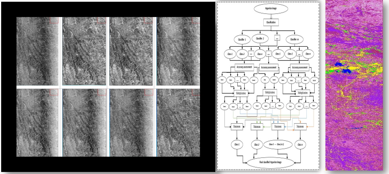
Key Research InterestsDevelopment of hyperspectral data processing techniques for mineral and lithological mapping, which includes, pre-processing techniques for noise reduction (random/salt-and- pepper noise and striping), illumination effects correction, topographic correction, atmospheric correction, spectral noise reduction and data size and dimensionality reduction, and post-processing techniques for vegetation suppression and unveiling surface lithology, and image classification for mineral and lithologic mapping. The key outcome of the research would be identification and quantification of targeted surficial lithology and minerals, which can assist in narrow down the targeted area for further study in mineral exploration. |
Publications |
Journals
|
Conferences
|