The various maps covered under this Project are as listed below
Soil Types
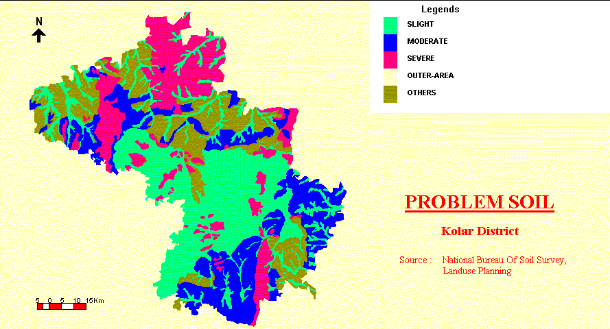
Problem Soils
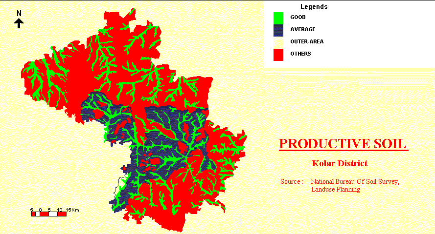
Productive soils
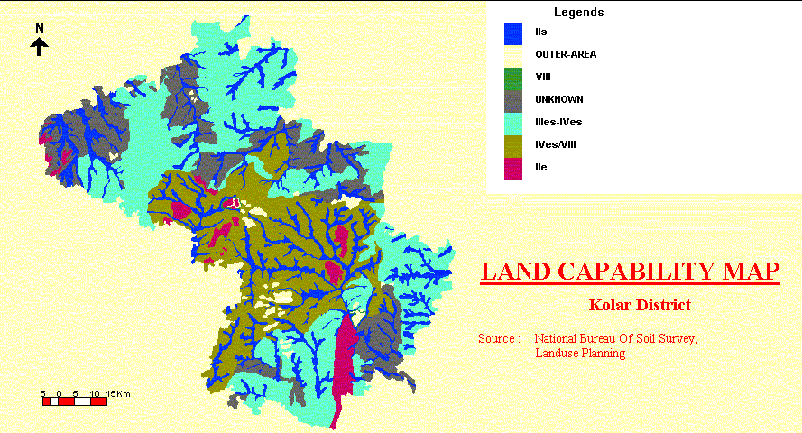
Land Capability
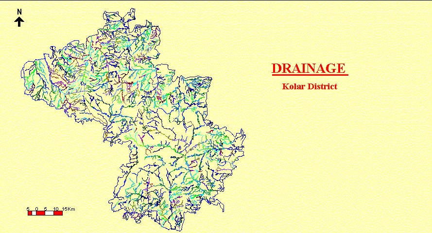
Drainage
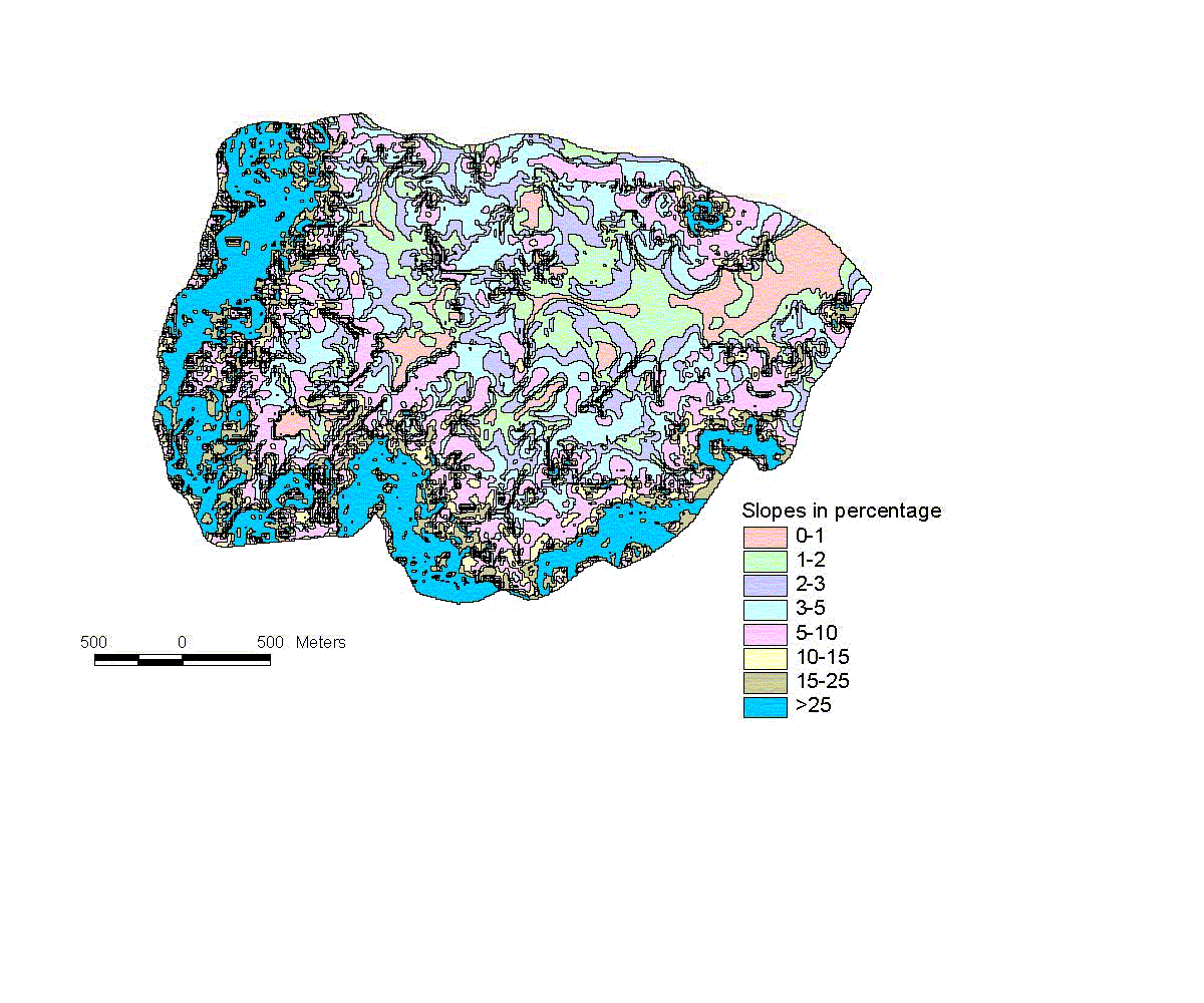
Slope
Watershed
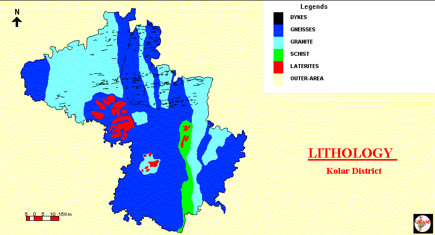
Geology
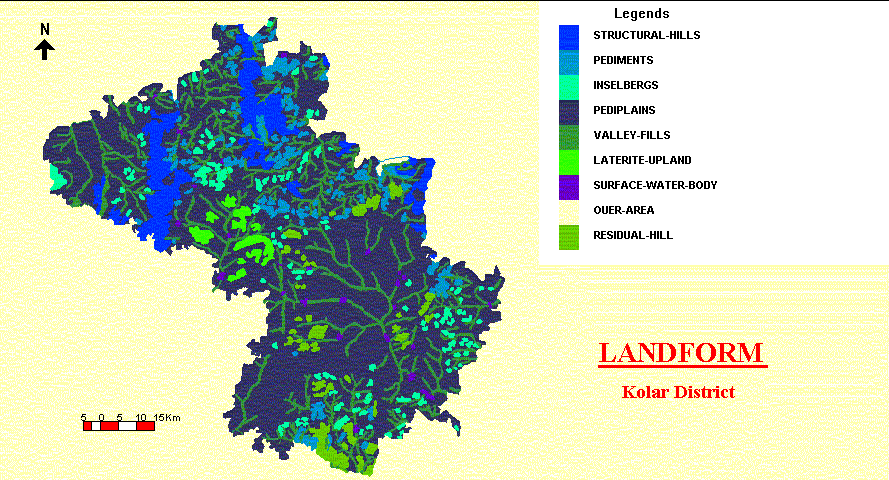
Landform
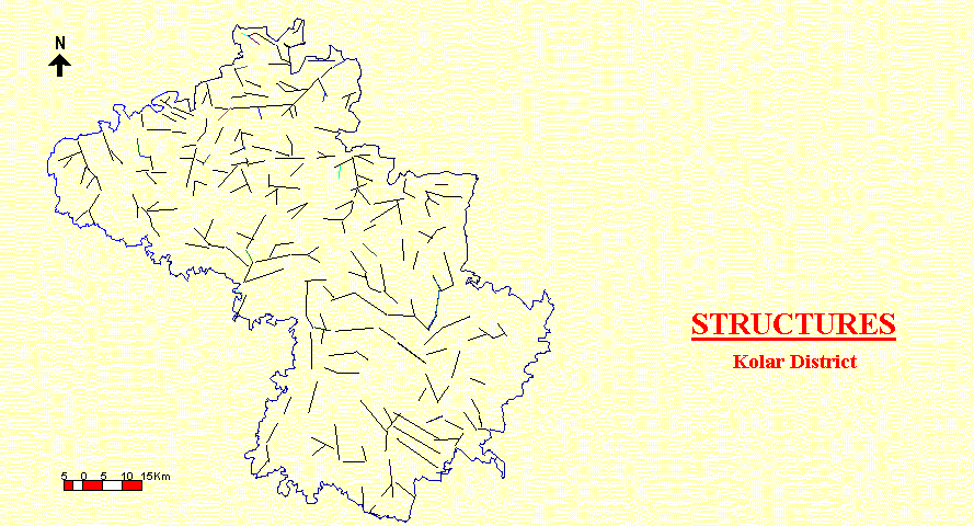
Structural map
Hydro-Geomorphic map
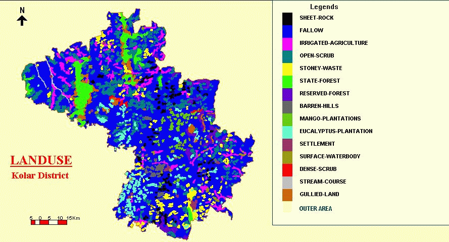
Land use
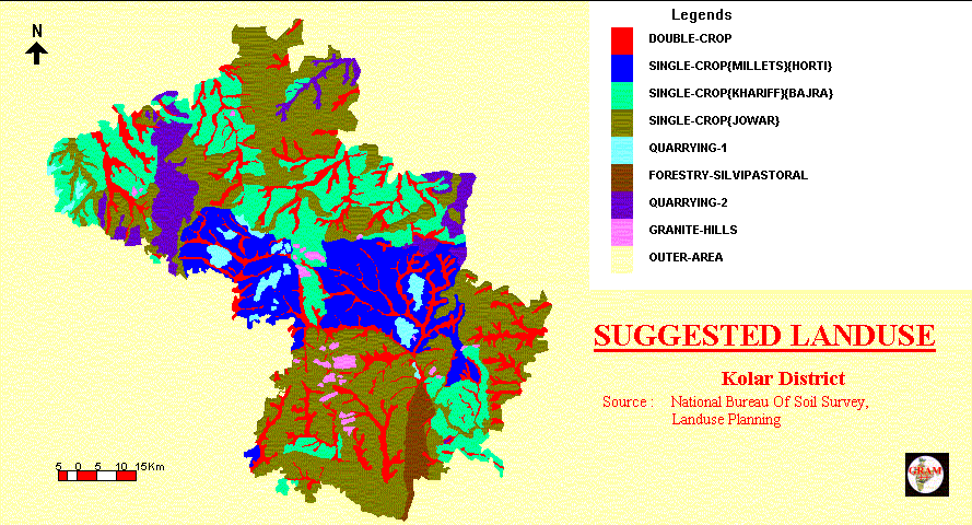
Suggested Land use
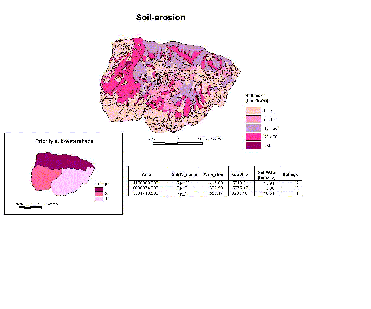
Soilerosion assessment
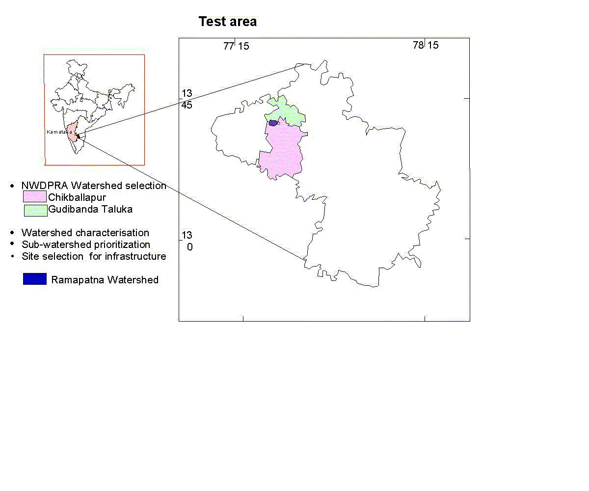
Test Area
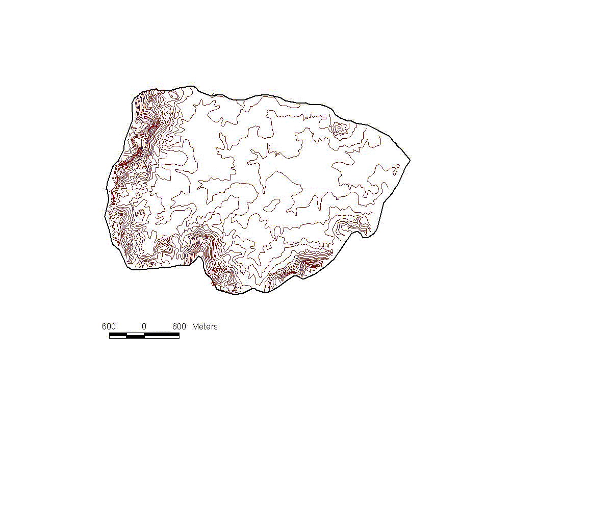
Contours
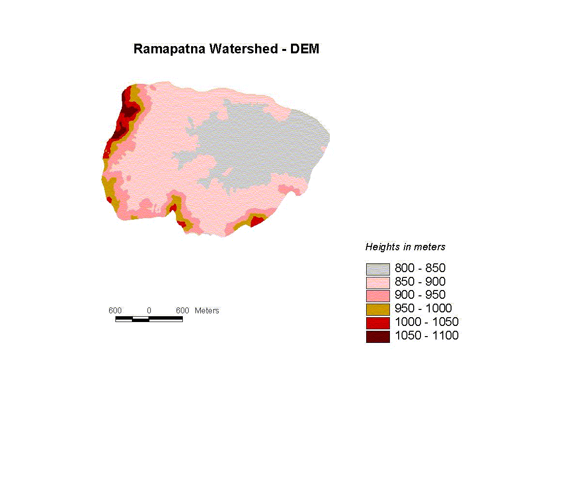
DEM
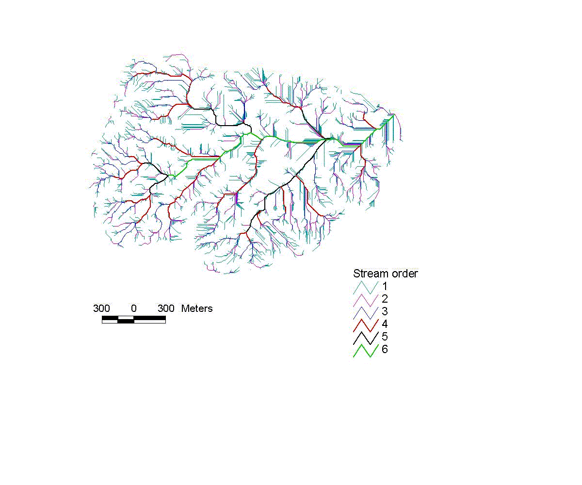
System generated drainage
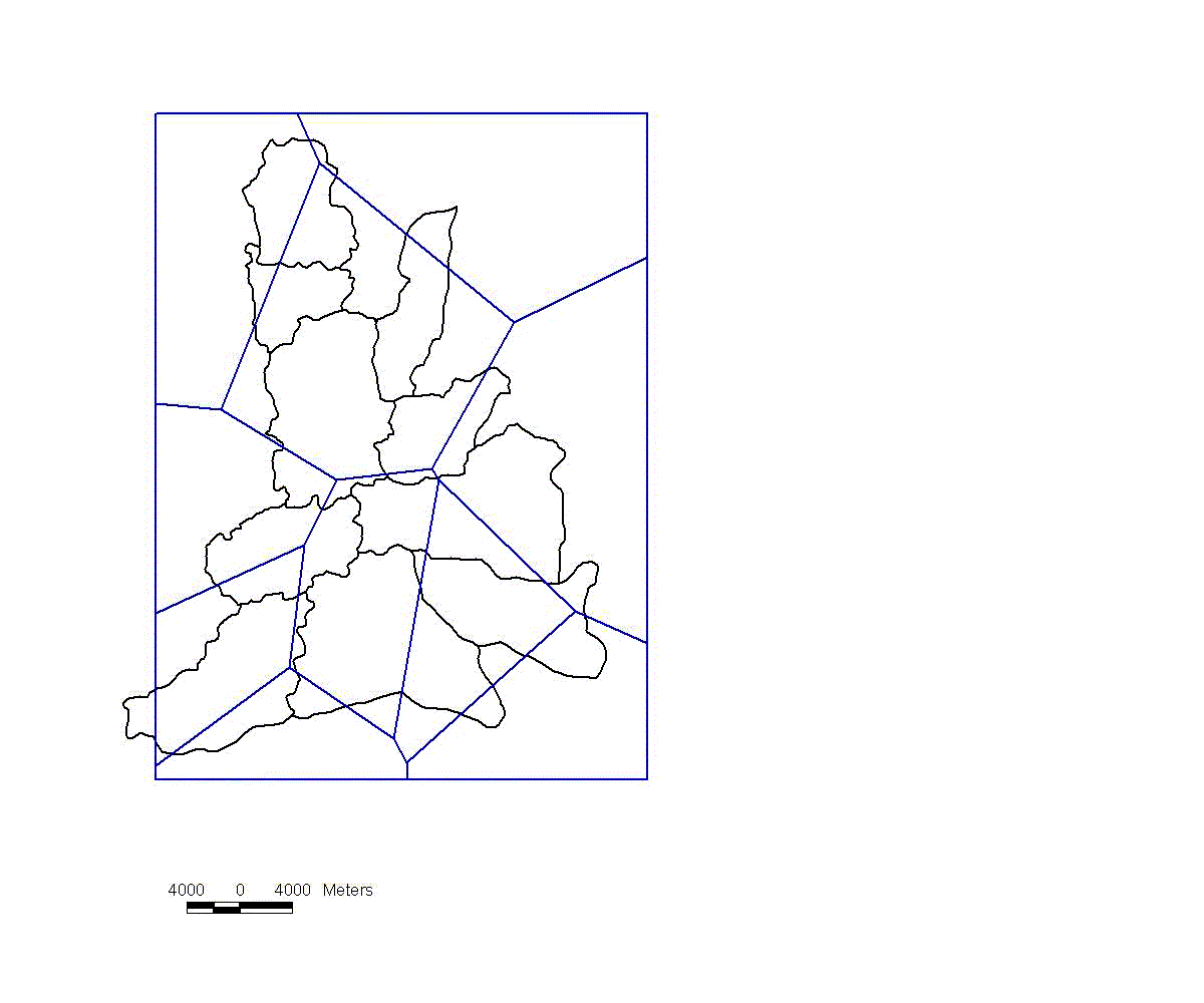
Theissen Polygons
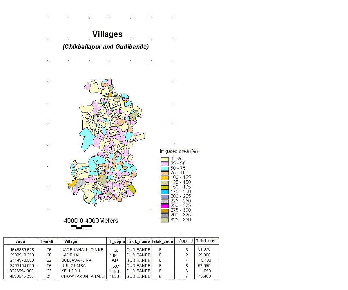
Chickballapur & Gudibana villages
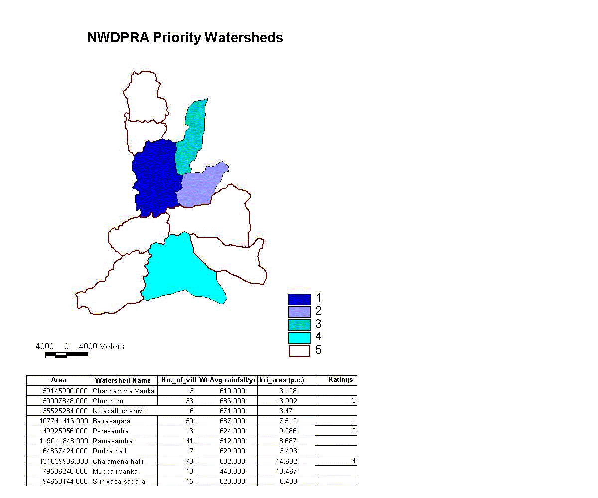
NWDPRA priority watersheds
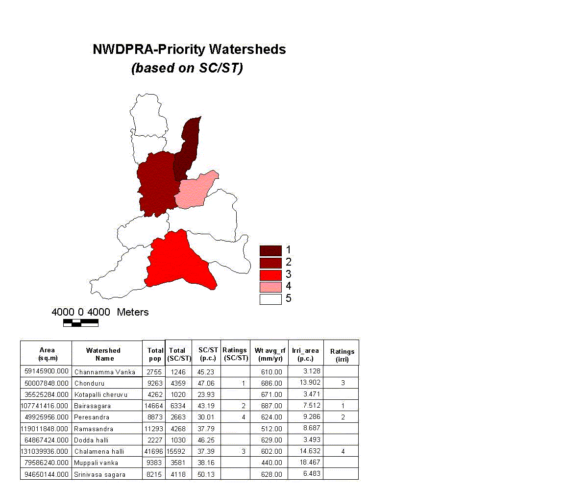
NWDPRA watersheds based on sc/st
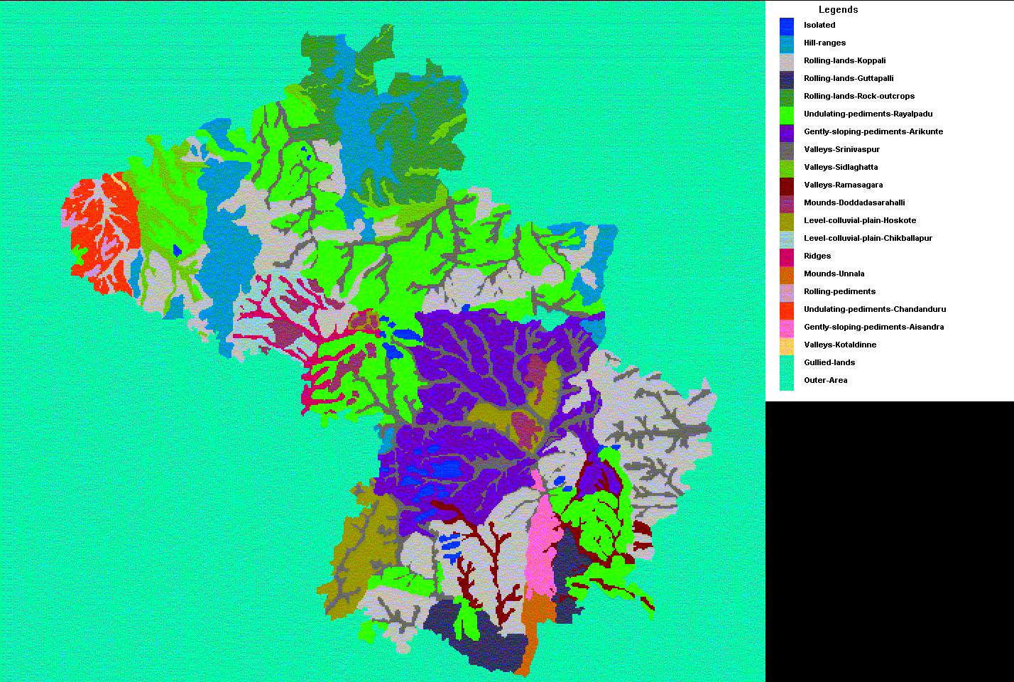
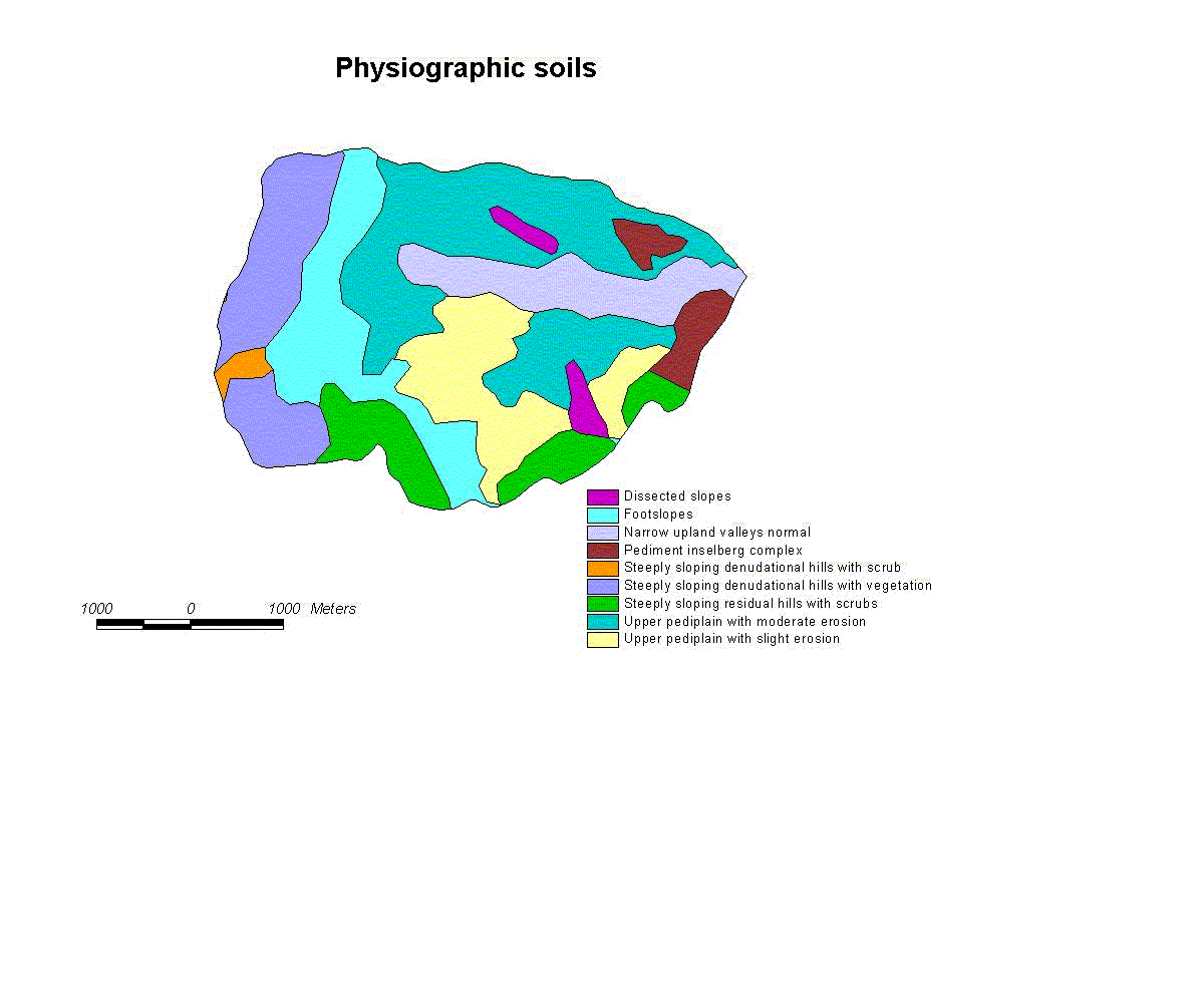
Physiographic soils
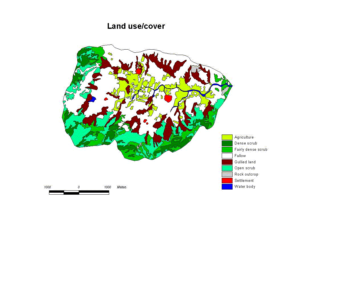
Landuse/cover
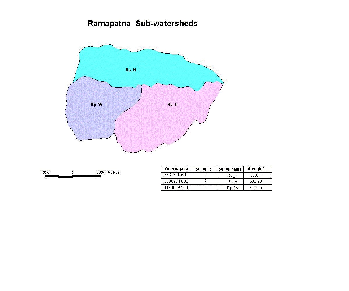
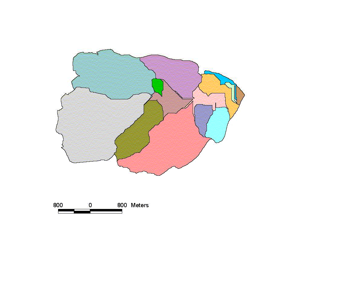
Ramapatna sub-watersheds
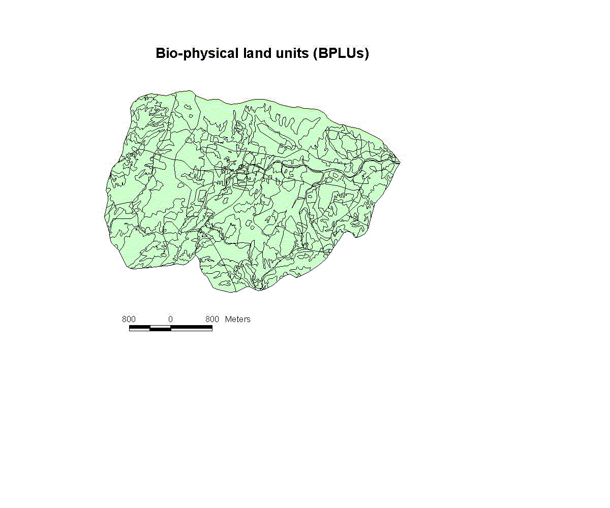
Bio-physical land units
Slope(system generated)
Sub-watershed(system generated)
Soil-erosion
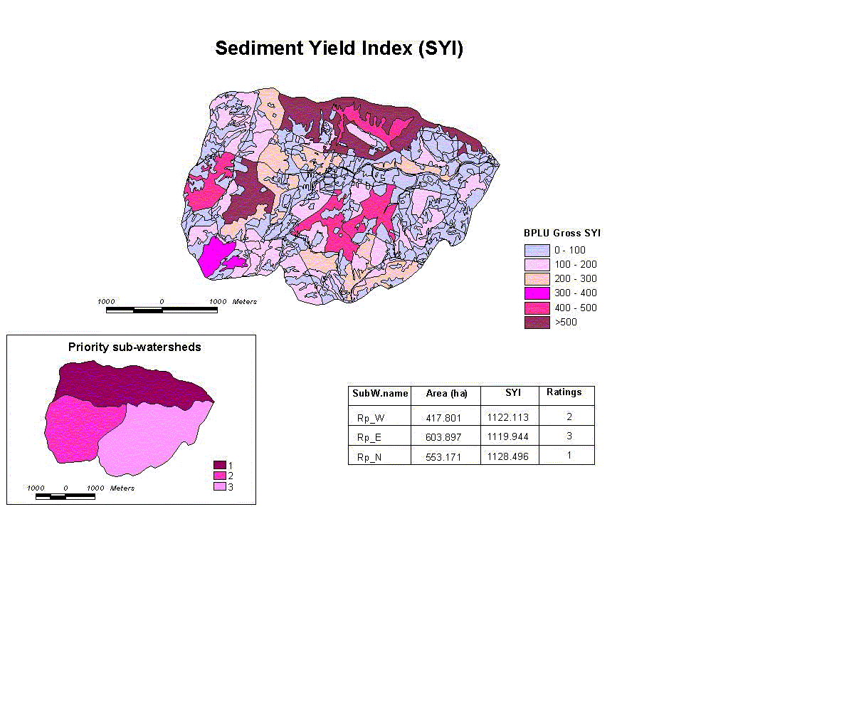
System Yield Index
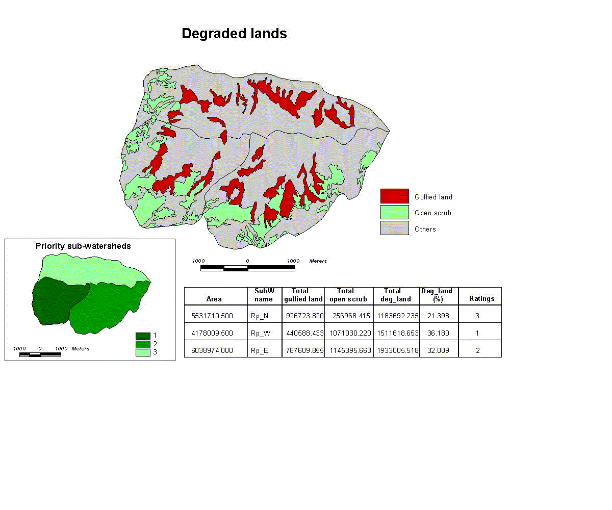
Degraded lands
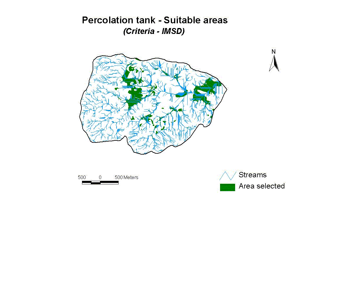
Percolation tank-Suitable Area
[Home]
|
[Back]
|
[Projects]