Agro-Informatics Lab
 |
Group Leader: Prof. J. Adinarayana |
|
|
Team Members: |
||
 |
Suchitra Mohan Patil (External PhD student) Area of Research: Virtual Plants for Plant Phenotyping |
|
 |
Saurabh Suradhaniwar (PhD. student/Teaching Assistant) Research Interest: Wireless Sensor Networks, Interoperability, Time Series Prediction, Fog Computing and Remote Sensing |
|
 |
Rohit Nandan (PhD. student/Teaching Assistant) Research Interest: Crop Modeling, Climate Change/ Variability, Crop Yield Intensification and Remote Sensing |
|
 |
Mukesh Kumar Vishal (Sponsored PhD. Student from ICAR) Research Interest: Agricultural Statistics, Crop Yield Modeling |
|

|
Rahul Waghmare (M.Tech student) Research Interest: Crop Biomass modeling |
|
|
|
Rohit Pingale (JRF/PTA) Research Interest: Crop Yield modeling |
|
|
Graduated Students: |
||
|
Dr. Rahul Raj |
||
|
Dr. Soumyashree Kar |
||
|
Dr. Vinod Kumar Yadav |
||
|
Dr. Mrunalini Badnakhe |
||
|
Dr. Sudharsan D |
||
|
Dr. Amiya Kumar Tripathy |
||
|
Dr. Prajakta D Aher |
||
|
Dr. Suryakant Sawant |
||
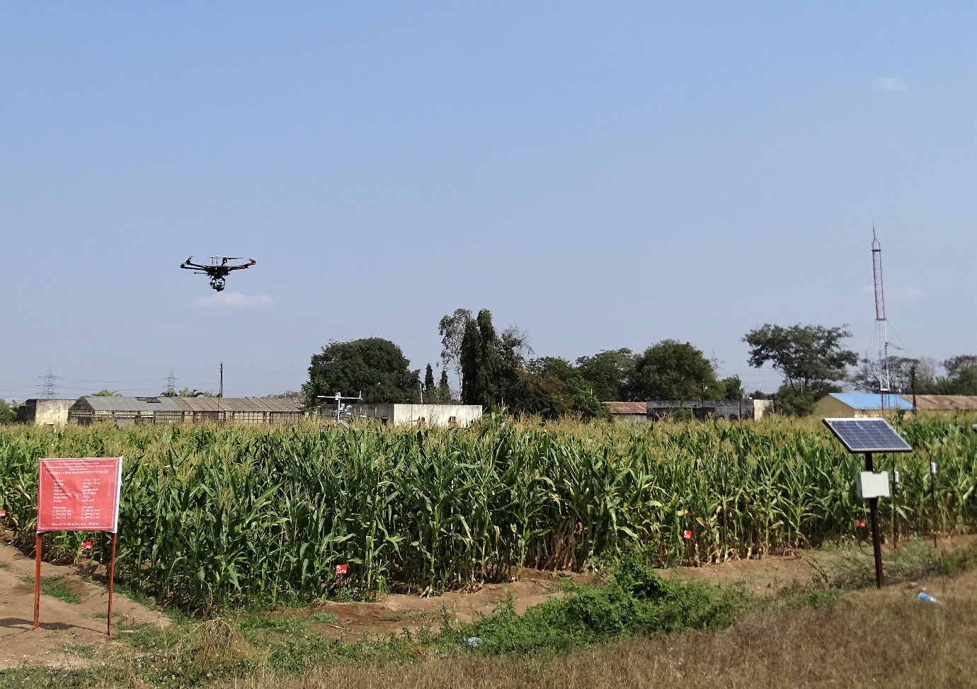
Agro-Informatics Lab primarily focuses on, developing and implementing innovative solutions (using disruptive technologies) for precision agriculture and the farming community as a whole. One of the flagship projects undertaken by Agro-Informatics lab was a bilateral (DST/JST) project between India (IIT Bombay) and Japan (The University of Tokyo and National Agricultural Research Center/Tsukuba), where the main objective was to develop a near-real time DSS (called GeoSense) for precision agriculture (crop modelling, precision irrigation and pest/disease modelling). The project involved design and development of novel data assimilation platforms (crowd sourcing, location based geo-tagging etc.), distributed sensing platforms AgriSense (IITB), FieldServer (NARO, Japan), WSN based flux measurements, controlled irrigation techniques, adaptation to climate variability and an online interface for decision making.
On-going projects
DSFS: Data Sciences for Farming Support Systems for Sustainable Crop Production Under Climate Change project (from Sept 2017) that involves multi-disciplinary consortium of research institutes under DST-JST scheme of Strategic International Collaborative Research Program (SICORP). The project involves data-science based approaches for high-end integration of information and agricultural sciences such as IoT, Bigdata analytics, crop modelling and omics (genomics and phenomics) to support high performance and sustainable agri-systems in semi-arid tropics of India.
GrIDSense: ICT in Water and Pest/Disease Management for Yield Improvement in Horticulture (Citrus), is an interdisciplinary and multi-institutional consortium-based project funded from Information Technology Research Academy (ITRA), an initiative of Media Lab Asia, DeITY. The project involves development of process / empirical based models for understanding plant-soil-water-weather-disease interactions under climate change. It also focuses on development of open-data sharing standards, sensor web enablement, open hardware standardization and interoperability between sensing platforms. ‘GrIDSense’ model, developed in the project with the help of consortium partners, is an interoperability platform for remote monitoring and decision making for precision agriculture. Novel IoT based platform SenseTube, was developed in collaboration with GeoSySIoT Group of CSRE (http://www.geosysiot.in/internet-of-things-iot/) for smart agriculture (Patent No 2236/MUM/2015)
The ongoing research in lab includes:
- Design and development of interoperable agro-meteorological observation and analysis platform for precision agriculture: Case study of Evapotranspiration.
- Development of citrus disease gummosis severity indices using hyperspectral observations and machine learning
- Application of interoperable, heterogeneous and open source wireless sensor networks for predictive time series analysis on edge devices.
- High Throughput Plant Phenotyping (HTPP) to understand plant behaviour on a larger scale (as against the tedious laboratory methods) as well as finer precision, to facilitate High-Performance Breeding. HTTP also aims at deriving precise estimations of crop phenotypes for improved statistical resolution among the genotypes (i.e. genetic diversity), which will help in identifying best water-stress resistant varieties. It considers environmental (ambient) variability and exploits both: dehydration-avoidance (using morphological parameters) and tolerance (using physiological parameters) mechanisms of the crops, from high-frequency time-series data of the underlying traits.
- Decision support system using Multilayer Canopy-Root-Soil (MLCan) model to optimize crop water and nitrogen use efficiency under climate variability using weather and UAV based observations.
- Application of AI and machine learning in crop phenology modelling using UAV and hyperspectral data
- Remote sensing and time series analysis for regional and field level estimation of crop growth stage, crop water requirement, atmospheric flux exchange (including flux partitioning), micro irrigation and SAP flow integration.
National/International Collaborators
Prof Seishi Ninomiya, University of Tokyo, Japan
Prof Udai Desai, IIT Hyderabad
Prof Praveen Kumar, Urbana, University of Illinois, USA
Prof Jeffrey Walker, Monash University, Australia
Dr Vincent, ICRISAT/Hyderabad
Dr C Viswanathan, Division of Plant Physiology, IARI, ICAR
Prof K B V N Phanindra, IIT Hyderabad
Prof R Gade, PDKV, Akola, Maharashtra
Indo-Japan collaborative critical zone observatory equipped with ground sensors, automatic weather station, ET flux tower and Hyperspectral imaging through drone